What Are the Potential Applications of Satellite Data Remote Sensing in the Future?
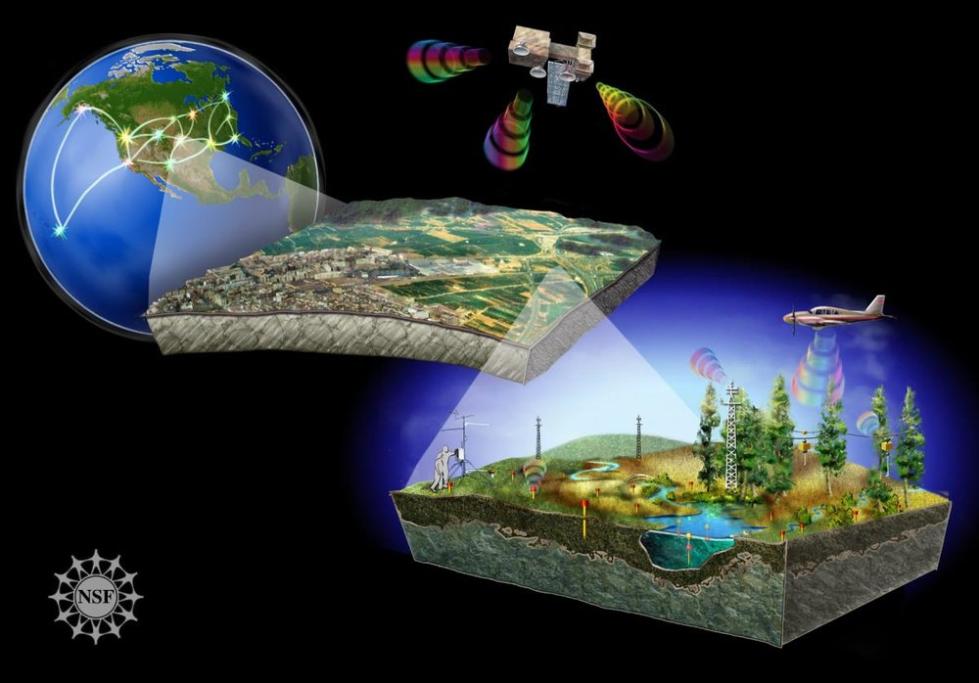
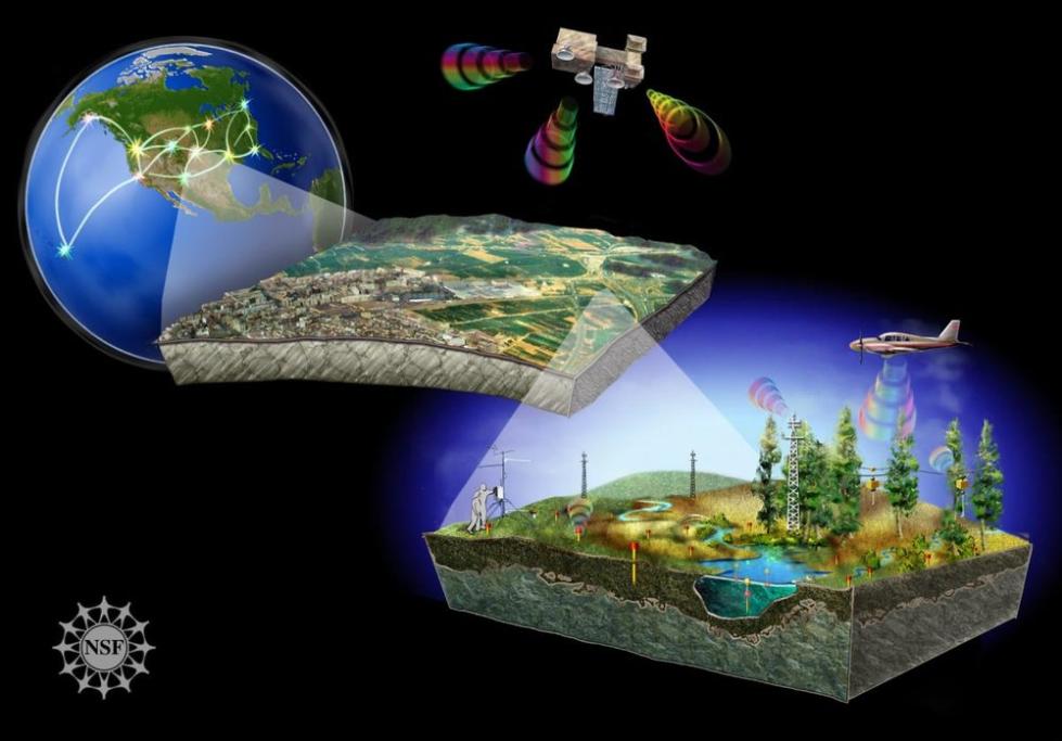
Remote sensing, the acquisition of information about an object or area without being in physical contact with it, has revolutionized data collection and analysis. Satellite data remote sensing, in particular, has emerged as a powerful tool for observing and monitoring various aspects of the Earth's surface and atmosphere.

Satellite data remote sensing offers several advantages over traditional methods of data collection. Satellites can provide a global perspective, enabling the monitoring of large areas in a short time frame. They can also collect data in various wavelengths, including visible, infrared, and microwave, allowing for the detection of different features and properties of the Earth's surface. Additionally, satellite data is often more accurate and consistent than data collected from ground-based sensors.
Current Applications Of Satellite Data Remote Sensing
Satellite data remote sensing is currently used in a wide range of applications, including:
- Agriculture: Crop monitoring, yield estimation, soil moisture analysis, and precision farming.
- Forestry: Forest cover mapping, deforestation monitoring, and forest fire detection.
- Water Resources Management: Water quality monitoring, water resource assessment, and flood and drought monitoring.
- Land Use and Planning: Land use classification, urban planning, and environmental impact assessment.
- Disaster Management: Natural disaster monitoring, early warning systems, and damage assessment.
- Climate Change Monitoring: Monitoring climate change impacts on ecosystems, carbon sequestration, and greenhouse gas monitoring.
- Biodiversity Conservation: Habitat mapping, species distribution assessment, and conservation planning.
Potential Applications Of Satellite Data Remote Sensing In The Future
The future of satellite data remote sensing holds immense potential for advancing our understanding of the Earth and addressing various global challenges. Some potential applications include:
Agriculture:
- Crop yield prediction: Satellite data can be used to monitor crop growth and predict yields, enabling farmers to make informed decisions about irrigation, fertilization, and pest control.
- Soil health monitoring: Satellite data can be used to assess soil moisture, nutrient content, and organic matter, helping farmers optimize soil management practices.
- Precision agriculture: Satellite data can guide farmers in applying inputs such as water, fertilizer, and pesticides more precisely, reducing waste and environmental impact.
Forestry:
- Forest carbon monitoring: Satellite data can be used to estimate forest carbon stocks and monitor changes in forest biomass, contributing to climate change mitigation efforts.
- Forest health monitoring: Satellite data can be used to detect signs of forest stress, such as insect infestations, diseases, and drought, enabling early intervention and management.
- Forest fire management: Satellite data can be used to monitor fire activity, predict fire spread, and provide real-time information to firefighters.
Water Resources Management:
- Water quality monitoring: Satellite data can be used to monitor water quality parameters such as turbidity, chlorophyll, and nutrient concentrations, helping to identify and address pollution sources.
- Water resource assessment: Satellite data can be used to estimate water availability, monitor groundwater levels, and assess the impact of climate change on water resources.
- Flood and drought monitoring: Satellite data can be used to monitor floodplains, track floodwater movement, and predict flood risk. It can also be used to monitor drought conditions and assess the impact of drought on agriculture and ecosystems.
Land Use And Planning:
- Urban planning and development: Satellite data can be used to monitor urban growth, identify informal settlements, and plan for sustainable urban development.
- Land use change monitoring: Satellite data can be used to monitor changes in land use, such as deforestation, urbanization, and agricultural expansion, and assess their environmental and social impacts.
- Environmental impact assessment: Satellite data can be used to assess the environmental impact of infrastructure projects, mining activities, and other human interventions.
Disaster Management:
- Natural disaster monitoring: Satellite data can be used to monitor natural disasters such as earthquakes, volcanic eruptions, landslides, and tsunamis, providing early warning and enabling timely response.
- Damage assessment: Satellite data can be used to assess the extent of damage caused by natural disasters, facilitating relief efforts and recovery planning.
- Recovery monitoring: Satellite data can be used to monitor the recovery of affected areas after natural disasters, tracking the progress of reconstruction and rehabilitation efforts.
Climate Change Monitoring:
- Climate change impact monitoring: Satellite data can be used to monitor the impacts of climate change on various ecosystems, including changes in vegetation, sea level rise, and glacier retreat.
- Carbon sequestration monitoring: Satellite data can be used to monitor carbon sequestration in forests and other ecosystems, contributing to the assessment of global carbon budgets.
- Greenhouse gas monitoring: Satellite data can be used to monitor greenhouse gas concentrations in the atmosphere, helping to track emissions and assess the effectiveness of climate change mitigation efforts.
Biodiversity Conservation:
- Habitat mapping: Satellite data can be used to map and monitor critical habitats for endangered species, enabling targeted conservation efforts.
- Species distribution assessment: Satellite data can be used to track the distribution and abundance of species, providing insights into their population dynamics and conservation status.
- Conservation planning: Satellite data can be used to identify areas of high conservation value and develop effective conservation strategies.
Challenges And Limitations Of Satellite Data Remote Sensing

Despite its immense potential, satellite data remote sensing faces several challenges and limitations:
- Data volume and processing requirements: Satellites generate vast amounts of data, which can be challenging to process and store.
- Atmospheric and cloud interference: Atmospheric conditions and cloud cover can interfere with satellite data collection, limiting the availability of usable data.
- Spatial and temporal resolution limitations: The spatial and temporal resolution of satellite data can be limited, affecting the level of detail and frequency of data collection.
- Data integration and interoperability issues: Integrating satellite data with other data sources and ensuring interoperability between different satellite systems can be challenging.
- Cost and accessibility of satellite data: Satellite data can be expensive to acquire and process, limiting its accessibility to some users.
Future Trends And Advancements In Satellite Data Remote Sensing
The future of satellite data remote sensing is promising, with several trends and advancements shaping its development:
- Miniaturization of satellites and constellations: The miniaturization of satellites and the development of satellite constellations are enabling more frequent and detailed data collection.
- Hyperspectral and multispectral imaging: Hyperspectral and multispectral imaging technologies are providing more detailed information about the spectral properties of objects, enhancing the ability to discriminate different features.
- Synthetic Aperture Radar (SAR) and Interferometric SAR (InSAR): SAR and InSAR technologies are providing new insights into surface topography, deformation, and soil moisture.
- Light Detection and Ranging (LiDAR): LiDAR technology is enabling the collection of high-resolution topographic data, providing detailed information about the Earth's surface.
- Artificial Intelligence and Machine Learning for data analysis: Artificial Intelligence and Machine Learning techniques are being applied to satellite data analysis, improving the accuracy and efficiency of data processing and interpretation.
- Integration with other data sources: Satellite data is increasingly being integrated with other data sources, such as IoT sensors, drones, and ground-based observations, providing a more comprehensive view of the Earth system.
Satellite data remote sensing holds immense potential for advancing our understanding of the Earth and addressing global challenges. With continued research and development, as well as international cooperation and data sharing, satellite data remote sensing will play an increasingly vital role in shaping a more sustainable and resilient future.
YesNo

Leave a Reply